Penal (Peñal)
Penal is a town in south Trinidad, Trinidad and Tobago. It lies south of San Fernando, Princes Town, and Debe, and north of Moruga, Morne Diablo and Siparia. It was originally a rice- and cocoa-producing area but is now a rapidly expanding and developing town. The population is 12,281.
The heart of Penal contains many businesses while the outskirts focus on agricultural development. Penal has a market, police station, branches of three banks (Scotiabank, Republic Bank and First Citizens Bank) health facilities, grocery stores, convenience stores, bars, fast food restaurants, service stations, restaurants, puja stores, an Indian expo, and clothing stores.
Penal plays a major role in the energy supply to the nation's populace. Petrotrin, the national oil company, has a major sub-unit in Clarke Road and the National Gas Company has gas lines running through Penal that links the gas fields of the South East Coast and the industrial estates. One of the countries three major power generating plants owned by Powergen Ltd is located at Syne Village to the west of Penal.
Abdool Village, Aquart Village, Backar Yard, Bakhen, Batchyia Village, Charlo Village, La Costena Gardens, Mendez Village, Digity Village, Penal Rock-Bunsee Tr. Village, Penal Quinam Road Village, Sou Sou Lands, San Francique and Syne Village are located in Penal.
Penal's local government is administered by the Penal–Debe Regional Corporation. Penal is a part of the Siparia and Oropouche West constituency.
The Trinidad and Tobago national cricket team have played matches holding first-class and List A status at the Wilson Road Recreation Ground.
* Kamla Persad-Bissessar – Seventh Prime Minister of Trinidad and Tobago
* Drupatee Ramgoonai – Chutney and Chutney Soca singer
* David Williams – cricketer
Map - Penal (Peñal)
Map
Country - Trinidad_and_Tobago
 |
 |
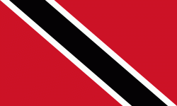
| Flag of Trinidad and Tobago | |
The island of Trinidad was inhabited for centuries by Indigenous peoples before becoming a colony in the Spanish Empire, following the arrival of Christopher Columbus, in 1498. Spanish governor José María Chacón surrendered the island to a British fleet under the command of Sir Ralph Abercromby in 1797. Trinidad and Tobago were ceded to Britain in 1802 under the Treaty of Amiens as separate states and unified in 1889. Trinidad and Tobago obtained independence in 1962, becoming a republic in 1976.
Currency / Language
| ISO | Currency | Symbol | Significant figures |
|---|---|---|---|
| TTD | Trinidad and Tobago dollar | $ | 2 |
| ISO | Language |
|---|---|
| ZH | Chinese language |
| EN | English language |
| FR | French language |
| ES | Spanish language |


